

LSU Leads Federal Study of Underwater Mudslides' Impacts in Gulf of Mexico
November 01, 2022
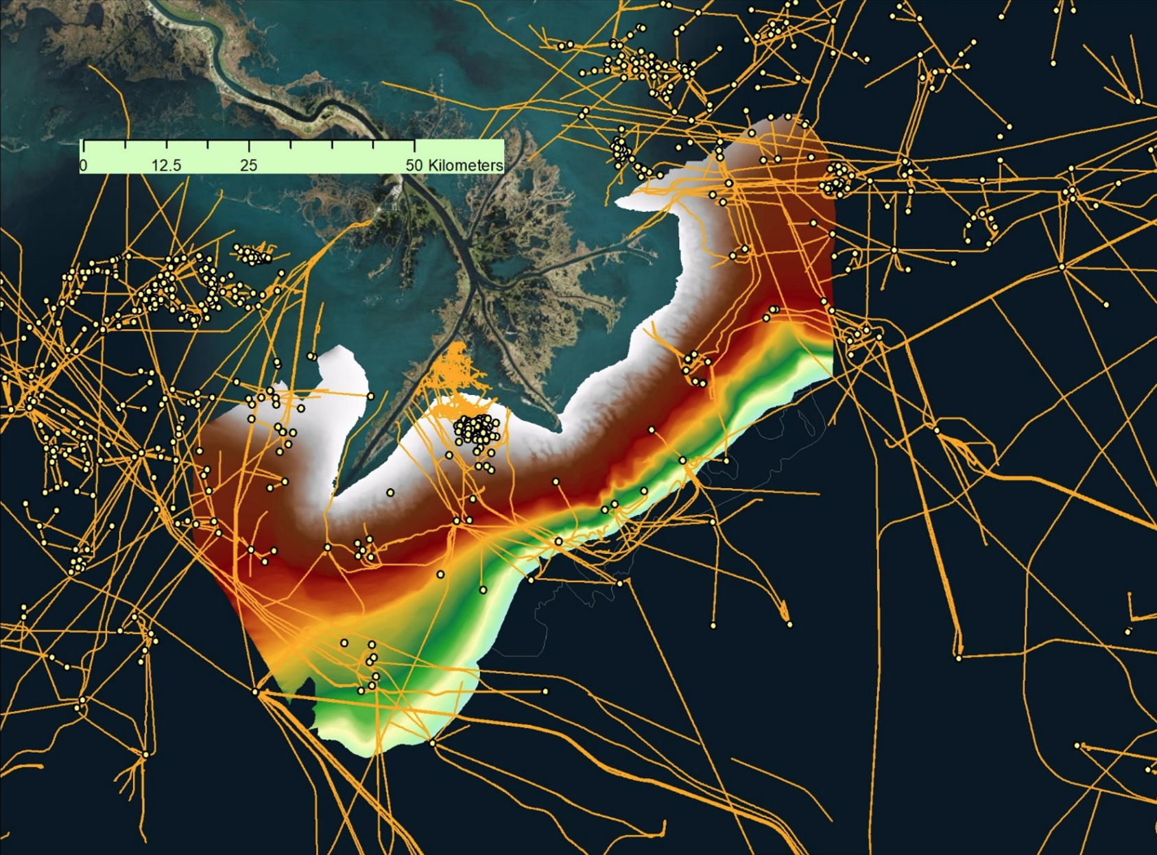
The Mississippi River Delta Front is the submerged, muddy apron around the mouth of the Mississippi River, or “bird’s foot.” The area is home to significant energy infrastructure; the dots on the map are platforms while the yellow lines are pipelines.
– LSU
LSU coastal researchers and federal partners are trying to understand underwater mudslides around the Mississippi River Delta, home to significant energy infrastructure, as well as several old shipwrecks.
“Our primary goal is to do a 21st century assessment of this hazard, and given the complexities and value of the problem, our state and federal partnerships provide the ideal team to do the job.” said LSU marine geologist Samuel J. Bentley.
LSU serves as a leader in developing the science, technology, and talent that will guide Louisiana and lead the Gulf Coast into the future.