


LSU Works with NASA to Foretell the Fate of the World’s Deltas—from Space
June 29, 2021
Helping Communities Around the Globe Choose Their Coastal Battles
While some deltas die, others thrive. Deltas are defined by rivers that carry sediment, which can build land over time. Leveed land, meanwhile, is often starved from sediment, and therefore more prone to sinking and erosion. This is true in Louisiana as well as in deltaic regions around the world.
LSU scientists are now collaborating with NASA and several other universities to map the Mississippi River delta region as part of a $15-million, five-year study. Their goal is to better understand how deltas rise and fall, and how rivers can be used as land-builders. LSU leads the field work, which involves mud-slogging on islands and taking very precise measurements from boats. Research on the ground and in the water is then combined with satellite and other data from NASA’s high-tech airborne systems to calibrate sensors and develop new computer models. These models can be used to determine—based on flyover data alone—which parts of dwindling deltas can be shored up and which are past hope, helping Louisiana and deltaic communities around the world choose their costly coastal battles amidst rising seas.
“I’ve been working here 15 years, and one of the toughest parts about working in a delta is you can only touch one little piece of it at any one time and understand one little piece of it at one time,” said Robert Twilley, LSU professor of oceanography and coastal sciences. “Now we have the capability of working with NASA to understand the entire delta.”
To figure out where to shore up dying deltas, LSU and NASA are studying water flowing in and out of Louisiana’s Atchafalaya and Terrebonne basins, sediment carried by it, and plants that can slow the flow, trap sediment, and pull carbon from the air. Planes and boats went out in March and April and will go out again this fall for a second set of measurements.
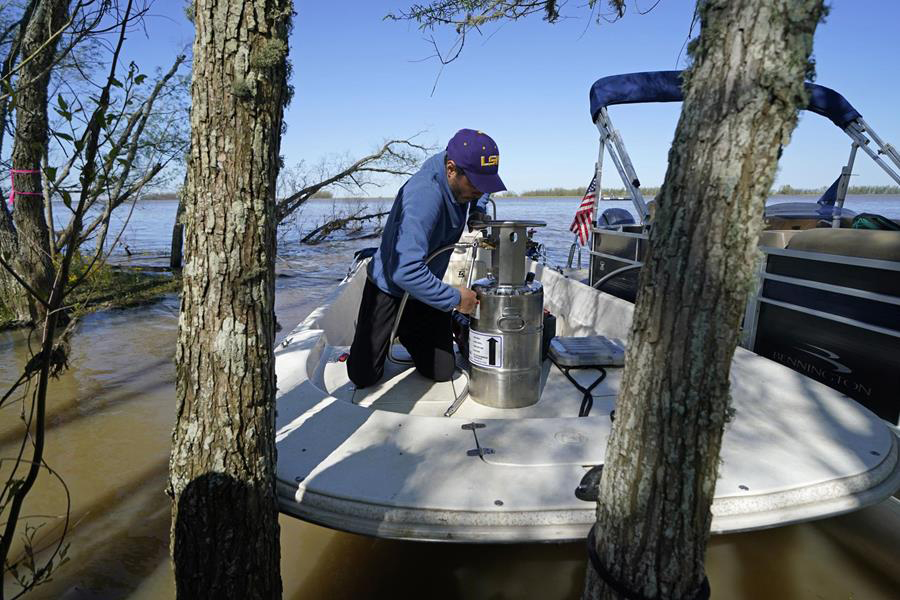
LSU research scientist Andre Rovai in the field.
– AP Photo/Gerald Herbert
“If you have to choose between saving an area and losing another instead of losing everything, you want to know where to put your resources to work to save the livelihood of all the people who live there. I have been working with researchers at LSU for over a decade, culminating in this project, which uses data from the Mississippi River delta region to calibrate our models and support decision-making around the globe.”
Marc Simard, lead scientist at NASA’s Jet Propulsion Laboratory, works closely with LSU on mapping the Mississippi River delta region