Open-File Series
Ordering Information:
 87-01 Soil Geomorphology of the Amite River
by W.J. Autin. 1987. 20 pp.
Describes and locates soils in a 2,000-square mile drainage area, with suggestions for improving soil survey accuracy in flood plains. Maps and references.
Price: $10.00
 87-02 Quaternary Depositional Surfaces of Western Louisiana
by R.H. Kesel. 1987. 16 pp.
Examines the Quaternary coastal terraces and the graveliferous terrace units in west Louisiana.
Price: $10.00
 87-03 Surface Impoundments Assessment Final Report for Louisiana
by W.J. Autin. 1987. 43 pp.
A record of the legislative and technical efforts to evaluate relationships between waste disposal practices and the comprehensive management of hazardous waste, with suggestions for further research.
Price: $15.00
87-04 A Preliminary Assessment of the Sand and Aggregate Resources of Three Areas of the Louisiana Inner Continental Shelf: Timbalier Islands, Chandeleur Islands, and Trinity Shoal
by J.R. Suter and S. Penland. 1987. 58 pp. A high-resolution seismic investigation suggests promising deposits of sand in all three areas. The authors recommend vibracore sampling for further confirmation.
Price: $15.00
 88-01 Analysis of the Environmental Effects of Sand Resource Utilization on the Louisiana
Continental Shelf
88-01 Analysis of the Environmental Effects of Sand Resource Utilization on the Louisiana
Continental Shelf
by J. Mossa. 1988. 71 pp. This study uses wave energy-refraction models to assess these possible changes. Includes 71 pages of wave-refraction diagrams based on various sand-removal scenarios.
Price: $20.00
 88-02 Tide Gage Data Summary (Appendix to Coastal Geology Technical Report 03)
by S. Penland, K.E. Ramsey, R.A. McBride, T. F. Moslow and K. A. Westphal. 198 . 125 pp.
Price: $15.00
 88-03 Tide Gage Descriptions and Data (Appendix to Coastal Geology Technical Report
No. 04)
88-03 Tide Gage Descriptions and Data (Appendix to Coastal Geology Technical Report
No. 04)
by S. Penland, K.E. Ramsey, R.A. McBride, J.T. Mestayer and K.A. Westphal. 1988. 68 pp.
Price: $15.00
 88-04 Benchmark Descriptions and Locations (Appendix to Coastal Geology Technical
Report No. 04)
88-04 Benchmark Descriptions and Locations (Appendix to Coastal Geology Technical
Report No. 04)
by S. Penland, R.A. McBride, T.F. Moslow, and Karen Westphal
Price: $10.00
 88-05 Carbon-14 Data Summary (Appendix to Coastal Geology Technical Report No. 04)
by S. Penland, K.E. Ramsey, R.A. McBride, J.T. Mestayer and K.A. Westphal. 1988. 4 pp.
Price: $10.00
 88-06 Reconnaissance Investigation of Shoreface and Inner Shelf Sand Resources in
Terrebonne Parish: Point Au Fer to Timbalier Island
88-06 Reconnaissance Investigation of Shoreface and Inner Shelf Sand Resources in
Terrebonne Parish: Point Au Fer to Timbalier Island
by S. Penland, J.R. Suter and R.A. McBride. 1988. 73 pp.
Seismic and vibracore data have identified 25 potential, nearby sand sources at Cat Island Pass and at Ship Shoal.
Price: $15.00
 88-07 Recharge Potential of Louisiana Aquifers: A Supplement to the State Aquifer
Recharge Map and Atlas Plates
88-07 Recharge Potential of Louisiana Aquifers: A Supplement to the State Aquifer
Recharge Map and Atlas Plates
by Don Boniol. 1988. 50 pp. plus appendix.
Accompaniment to the State Aquifer Recharge Map and Atlas plates. Capsule introductions
to geohydrology, aquifer recharge, and soils recharge potential. Maps for this publication
are available from the Louisiana Department of Environmental Quality, Ground Water Protection, P.O. Box 82178, Baton Rouge, Louisiana 70884 (telephone
225-765-0585).
Price: $15.00
 88-08 Nearshore Sand Resources in the Eastern Isles Dernieres Barrier Island Arc
by S. Penland and J.R. Suter. 1988. 185 pp.
A preliminary assessment of the sand resources of the region around the eastern Isles Dernieres in Terrebonne Parish, Louisiana, with an eye toward possible use of such sands for barrier island stabilization.
Price: $20.00
89-01 Water Level Change, Sea Level Rise, Subsidence, and Coastal Structures in Louisiana: An Annotated Bibliography
by L.D. Nakashima and L.M. Loudon. 1989. 27 pp.
A comprehensive listing of publications focusing on water-level and eustatic change,
regional subsidence, coastal structures, hurricane impacts, shoreline change, wetland
modification, nearshore processes, and headland morphology.
Price: $15.00
 90-01 Wetland Valuation for Petroleum-related Operations
by D.K. Batker, J.E. Johnston, III, M.A. Surman, W.C. Kimbrell and J.L. Richard. 1990. 54 pp.
Examines the feasibility of wetland valuation, suggests methodologies, and provides recommendations for further study.
Price: $15.00
 90-02 Oil and Gas Fields of Louisiana: The Nebo-Hemphill Field, LaSalle Parish, Louisiana
by Paul N. Lawless and George F. Hart. 1990. 88 pp.
Traces the structural development of the LaSalle arch in north central Louisiana and describes hydrocarbon reserves within the Nebo-Hemphill Field.
Price: $20.00
91-01 Geologic and Derivative Engineering Geology Hazard Maps of East Baton Rouge Parish, Louisiana
by W. J. Autin and R. P. McCulloh . 1991 .
File copies available at Louisiana Geological Survey office for review only.
contact Pat O'Neill at poneil@lsu.edu to schedule an appointment
Price: NA
 91-02 Surface Faults in East Baton Rouge Parish
by R. P. McCulloh . 1991 . 25 pp. plus five plates . $15 for text only.
Investigates the two active faults that traverse East Baton Rouge Parish and affirms the existence of other linear surface discontinuities. Includes 5 folded maps
Price: $25.00 for text only, $30.00 for text and maps
 91-03 September Sweep: Louisiana’s 1987 Beach Cleanup
by D.M. Lindstedt and J.C. Holmes. 1988. 35 pp.
Records and analyzes the results of surveys taken during the first statewide Louisiana Coastal Cleanup, held 19 September, 1987. Information gathered by the participants provides the first statewide overview of coastal debris.
Price: $10.00
 92-01 Surface Geologic Mapping in Louisiana: History, Present Status, and Future Prospects
by R. P. McCulloh . 1992 . 20 pp.
Reviews geologic mapping activity in Louisiana from 1934, comparing the decline in geologic mapping in Louisiana to the national decline.
Price: $10.00
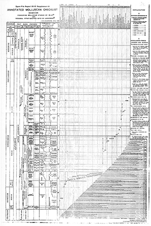 93-01 Annotated Molluscan Checklist
by F. M. Swain and E. G. Anderson . 1993 . Chart .
Chart should be purchased with Geological Bulletin No. 45.
Price: $15.00
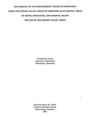 93-02 Occurrence of 53 Characteristic Species of Ostracoda from the Cotton Valley
Group of Northern Gulf Coastal Areas by Depth, Formation, and Interval Below the Top
of the Cotton Valley Group
93-02 Occurrence of 53 Characteristic Species of Ostracoda from the Cotton Valley
Group of Northern Gulf Coastal Areas by Depth, Formation, and Interval Below the Top
of the Cotton Valley Group
by F. M. Swain and E. G. Anderson . 1993 . 99 pp.
Report should be purchased with Geological Bulletin No. 45.
Price: $20.00
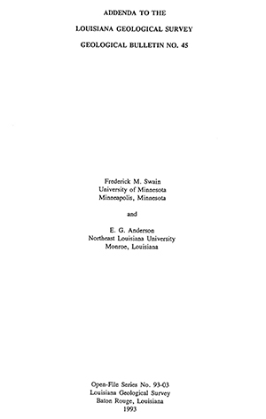 93-03 Addenda to the Louisiana Geological Survey Geological Bulletin No. 45
by F. M. Swain and E. G. Anderson . 1993 . 3 pp.
Should be purchased in addition to Geological Bulletin No. 45.
Price: $10.00
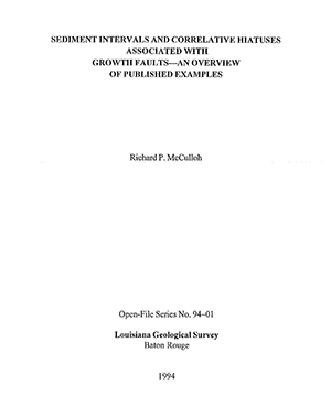 94-01 Sediment Intervals and Correlative Hiatuses Associated with Growth Faults —
An Overview of Published Examples
94-01 Sediment Intervals and Correlative Hiatuses Associated with Growth Faults —
An Overview of Published Examples
by R. P. McCulloh . 1994 . 18 pp. plus appendix
Describes a stratigraphic configuration associated with some growth faults, characterized by thick downthrown sequences lacking upthrown equivalents, and summarizes references to this configuration in published literature and unpublished works.
Price: $10.00
 94-02 Distinctive Patterns in Areal Distribution of Undifferentiated Alluvium of Upland
Streams in North Louisiana
94-02 Distinctive Patterns in Areal Distribution of Undifferentiated Alluvium of Upland
Streams in North Louisiana
by R. P. McCulloh . 1994 . 19 pp.
Examines the drastic pinching and swelling that characterizes certain individual alluvial bottomlands, and the rectilinear patterns, suggestive of structural influence, that characterize some networks of bottomlands in north Louisiana.
Price: $10.00
 95-01 Cumulative/Secondary Impact Identification and Evaluation of Authorized and
Exempted Activities and in the Louisiana Coastal Zone, Phase I
95-01 Cumulative/Secondary Impact Identification and Evaluation of Authorized and
Exempted Activities and in the Louisiana Coastal Zone, Phase I
by Aaron Bass . 1995 . 44 pp. plus appendices.
A review of impacts associated with activities exempt from the Louisiana Department
of Natural Resources, Coastal Management Division, regulatory authority. Includes
total impact calculations by habitat type for activities occurring in fastlands and
lands greater that 5 feet MSL, from 1981 to 1994
Price: $15.00
 95-02 Depositional Systems of the Lower Miocene of Cameron Parish, Louisiana, and
Their Relationship to the Occurrence and Production of Oil and Gas
95-02 Depositional Systems of the Lower Miocene of Cameron Parish, Louisiana, and
Their Relationship to the Occurrence and Production of Oil and Gas
by Michael Brister . 1995 . 34 pp. plus 4 cross sections.
A semiregional study of the Lower Miocene section located onshore Cameron Parish in
southwest Louisiana. Investigates the relationship of sediment depositional patterns
to the occurrence of oil and gas fields, which primarily occur in structural traps
created contemporaneously with deposition of interfingering sands and shales along
the shelf margin. Includes 4 cross sections.
Price: $50.00
 96-01 Topographic Criteria Bearing on the Interpreted Placement of the Traces of Faults
of the Baton Rouge System in Relation to Their Fault-line Scarps
96-01 Topographic Criteria Bearing on the Interpreted Placement of the Traces of Faults
of the Baton Rouge System in Relation to Their Fault-line Scarps
by R. P. McCulloh . 1996 . 23 pp. .
Supplements and sets forth more explicitly the analysis of geomorphic expression used
in OFS 91-02 to map the traces of active surface faults of the Baton Rouge system
at the toe positions of their fault-line scarps in East Baton Rouge Parish. Documents
the distinctive topographic patterns of substantial regularity shown by these scarps,
and interprets them as examples of variable slope reduction.
Price: $11.00
 96-02 Cumulative/Secondary Impact Identification and Evaluation in the Louisiana Coastal
Zone, Phase II: A Biological Characterization of a Representative Fastland Marsh and
an Adjacent non-Fastland Estuarine Marsh
96-02 Cumulative/Secondary Impact Identification and Evaluation in the Louisiana Coastal
Zone, Phase II: A Biological Characterization of a Representative Fastland Marsh and
an Adjacent non-Fastland Estuarine Marsh
by Aaron Bass . 1996 . 124 pp. plus appendices .
A 12-month study conducted at Bayou Sauvage National Wildlife Refuge (Orleans Parish),
focusing on biomass export from a fastland to adjacent coastal waters through a municipal
pumping station and through a stop-log water control structure. Presents data, summaries,
and interpretations based on sites sampled, and includes an analysis of the uses and
interrelationship between the environment of the fastlands and the immediately adjacent
area.
Price: $20.00
 96-03 Marsh Buggy and Airboat Use in Marsh Habitats, Phase I
by Aaron Bass . 1996 . 54 pp. plus appendices .
A literature review on the adverse impacts caused by marsh buggies and airboats in
the coastal zone. Phase I covers (1) summaries of relevant literature associated with
impacts; (2) a summary of direct and secondary impacts based on the literature review
and other sources; and (3) review of currently used technology and work methodologies
used to conduct 3-D seismic surveys.
Price: $15.00
 97-01 Potential Seismic Risk Associated with Louisiana Wrench Faulting
by Dave Meloy and Ron Zimmerman . 1997 . 45 pp. .
An overview of the middle Mesozoic zone of crustal weakness, caused by transform faulting
in the north-central gulf coastal area, during plate separation and rifting, which
may have become zones of subsequent tectonic adjustments, and the possible physical
structural link between a known major, active earthquake zone — the New Madrid — and
areas of recorded earthquakes.
Price: $15.00
97-02 Marsh Buggy and Airboat Use in Marsh Habitats, Phase II
by Aaron Bass . 1997 . 59 pp. plus appendices .
An investigation of the environmental impacts on and recovery rates of vegetation
and soil sustained by the use of marsh buggies and airboats associated with seismic
surveys in the Louisiana coastal zone, studied in two federal wildlife refuges.
Price: $15.00
04-01 Surface Geology of Calcasieu Parish, Louisiana
by Saul Aronow with preface by Paul Heinrich, 2004, 22 pp.
Price: $15.00
06-01 Monitoring Saltwater Front within Sparta Aquifer in North Central Louisiana
by Douglas Carlson and Thomas Van Biersel, 2010, 40 pp.
Discusses the extent of the Sparta Aquifer, usage patterns, and chloride concentrations in affected parishes.
Price: $15.00
10-02 Distribution of Chemical Agents Which are Adversely Impacting Water Quality That are Related to Lignite Within Aquifers of Northwestern Louisiana
Price: $15.00
 Columnar Section of Differentiated Wilcox Group Strata Exposed in Northwest Louisiana
by Richard P. McCulloh, 2016, 4 pp.
Compiled from information presented in Murray (1948) and Andersen (1960, 1993). Presents an attempt to graphically summarize in a single diagram essential information pertaining to differentiated surface Wilcox Group strata in northwest Louisiana given for De Soto and Red River parishes by Murray (Geological Bulletin 25, 1948) and for Sabine and Natchitoches parishes by Andersen (Geological Bulletin 34, 1960, and Geological Bulletin 44, 1993).
Price: $10.00. Digital copy available.
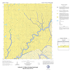
 16-01 Pioneer 7.5 minute Geologic Quadrangle Map
by Rick McCulloh and Paul Heinrich
Price: $55.00
16-02 Epps 7.5 minute Geologic Quadrangle Map
by Rick McCulloh and Paul Heinrich
Price: $55.00
16-03 Pride 7.5 minute Geologic Quadrangle Map
by Rick McCulloh and Paul Heinrich
Price: $55.00
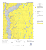
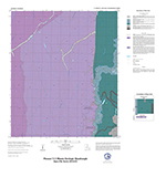
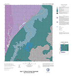
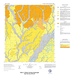
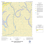
16-04 Watson 7.5 minute Geologic Quadrangle Map
by Rick McCulloh and Paul Heinrich
Price: $55.00
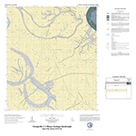
17-01 Lafayette 7.5 minute Geologic Quadrangle Map
by Rick McCulloh and Paul Heinrich
Price: $55.00
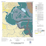
17-02 Broussard 7.5 minute Geologic Quadrangle Map
by Rick McCulloh and Paul Heinrich
Price: $55.00
17-03 Milton 7.5 minute Geologic Quadrangle Map
by Rick McCulloh and Paul Heinrich
Price: $55.00
17-04 Watson 7.5 minute Geologic Quadrangle Map
by Rick McCulloh and Paul Heinrich
Price: $55.00
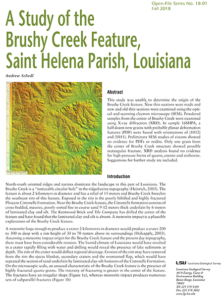 18-01 A Study of the Brushy Creek Feature, St. Helena Parish, Louisiana
by Andrew Schedl
Free, just click on the image to download.
 21-01 Electrical Resistivity Surveys of Mock Clandestine Graves in Outdoor Forensic
Laboratories
21-01 Electrical Resistivity Surveys of Mock Clandestine Graves in Outdoor Forensic
Laboratories
by Marty Horn, PhD
Free, just click to on the image download.